Brussels. From expressways to avenues
With a population of 1.2 million, the Brussels-Capital Region is the European Union (EU) Capital and one of Europe’s major metropolitan hubs; it lies at the heart of a metropolitan region of over 2.7 million residents living across the Capital Region and the two provinces of Flemish Brabant (Landers Region) and the Walloon Brabant (Wallon Region). The Capital Region is made up of 19 municipalities, the largest being the City of Brussels.
Recognising the significant social and environmental damages generated by car-based urban planning and mobility, Brussels-Capital’s officials have recently vowed to transform the highways penetrating within the city-region’s close periphery into urban boulevards. This effort is part of a wider urban development strategy, which seeks to concentrate future metropolitan growth in selected priority mix-use urban centres, including some areas on the urban fringe.
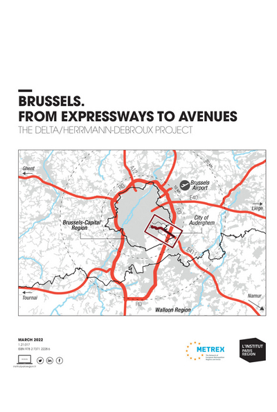
The Delta/Herrmann-Debroux highway corridor is one of such areas, located at the South-East of the Brussels’ Region in the municipality of Auderghem (Oudergen in Flemish) next to the boundary with the Flemish Brabant Region. Until today, the development of the area has been largely shaped and partly undermined by the presence of a major segregated motorway known as the E411.
Brussels-Capital Region’s Master Plan for the sector, the Delta/Herrmann-Debroux Sustainable Development Plan (PAD), should be approved in 2022. It aims to transform the E411 highway into a multimodal boulevard as well as to reconvert the adjacent sites into a people-oriented vibrant urban area.
See also
This study is linked to the following themes :
International |
Urban planning
