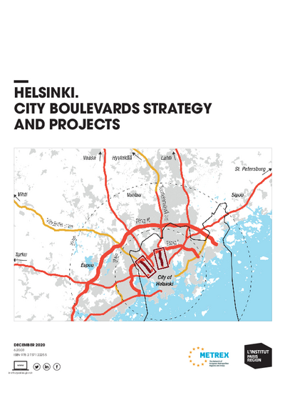
Helsinki. City boulevards strategy and projects
With a metropolitan population of almost 1.7 million and 656,000 inhabitants in the city itself, Helsinki is Finland’s major urban hub and capital-city. Located on the Baltic Sea, the city is a major national gateway for maritime traffic, with passenger and goods traffic being in turn discharged in the heart of the city onto an extensive regional highway.
After the Second World War, Helsinki’s development turned from urban to suburban, guided by the functionalist zoning principles with a strong reliance on car-based infrastructure. Today, this low density decentralised heritage is challenged by people’s aspiration for more vibrant ways of life and by the need to find space for a growing economy and population: the City of Helsinki’s 2016 Masterplan advocates for the emergence of denser, mixed-use neighbourhoods, with most urban facilities and services easily accessible within walking or cycling distance.
The transformation of Helsinki’s seven expressways within the Ring 1 motorway into urban “city boulevards”, also known as “boulevardisation”, is a core tool for the City to achieve this density-oriented development policy: the City’s Masterplan anticipates that one third of future urban growth will happen along these new boulevard. However, this strategy needs to be tested locally and shared with the national and regional authorities, currently not aligned on this strategy. The two first tests-beds for change will be the Vihdintie and Huopalahdentie highways and the Tuusuulan expressway linking the city centre to the airport.
This study is linked to the following themes :
International |
Urban planning