Oakland, New York: when the tactical approach reveals the importance of dialogue with local communities

08 February 2022Lisa Gaucher, Maximilian Gawlik

This third issue of the articles on tactical urbanism is based on two interviews conducted by L’Institut Paris Region in May 2021 with Ryan Russo, Director of the Department of Transportation of the City of Oakland, California and with Erwin Figueroa, then Director of Organizing at Transportation Alternatives, New York.

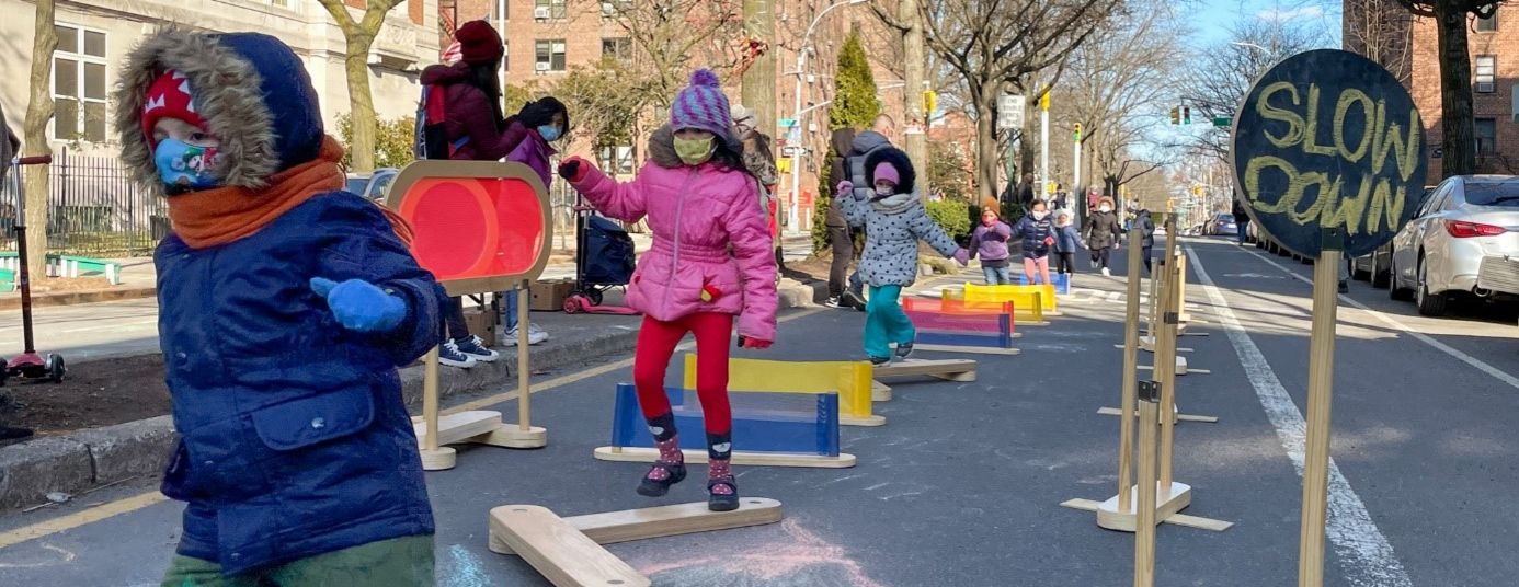
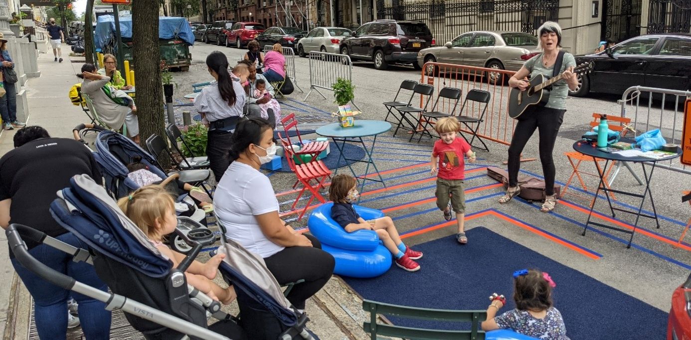
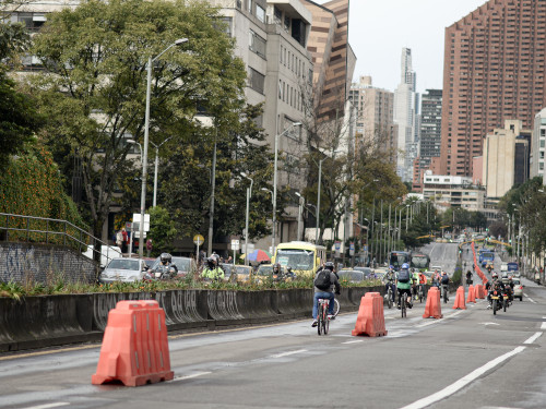
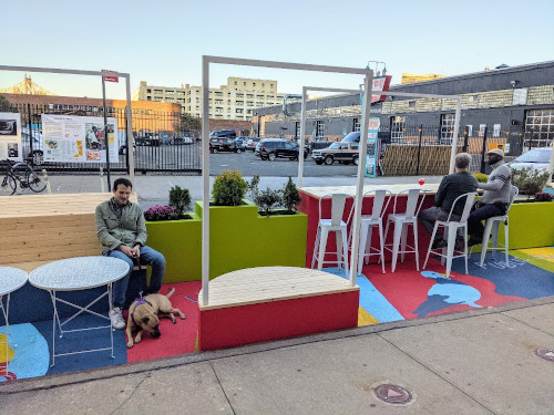
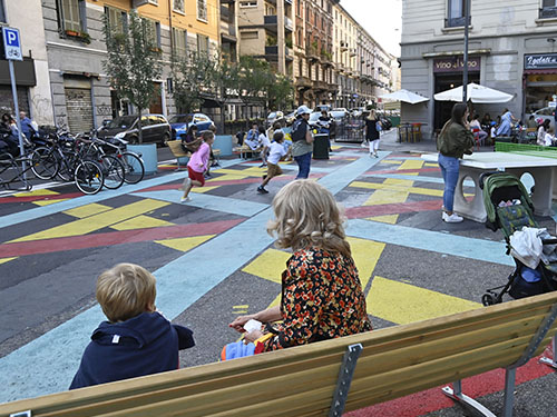
PARK(ing) Day in San Francisco (2005), Plaza Program in New York (2008) or Play Streets in various American cities (2010), for several years now, examples of tactical approaches, have flourished in the United States of America, a country often referred to as the homeland of tactical urbanism. As in Europe, North American cities have had to quickly adapt their public spaces to meet the challenges of physical distancing, due to COVID-19 health crisis. As part of the Slow Streets and Essential Places programmes in Oakland and Open Streets1  in New York, certain neighbourhood streets were temporarily transformed. Vehicle access was closed entirely or largely reduced, giving active modes (pedestrians and cyclists) space to move around safely. Very quickly, these streets also became playgrounds or sports grounds for all types of users. But despite the media success of these initiatives, they have not always been well received by communities. Today, their transformation into permanent designs remains an issue.

Slow Streets: Oakland's experiment with calming neighbourhood streets

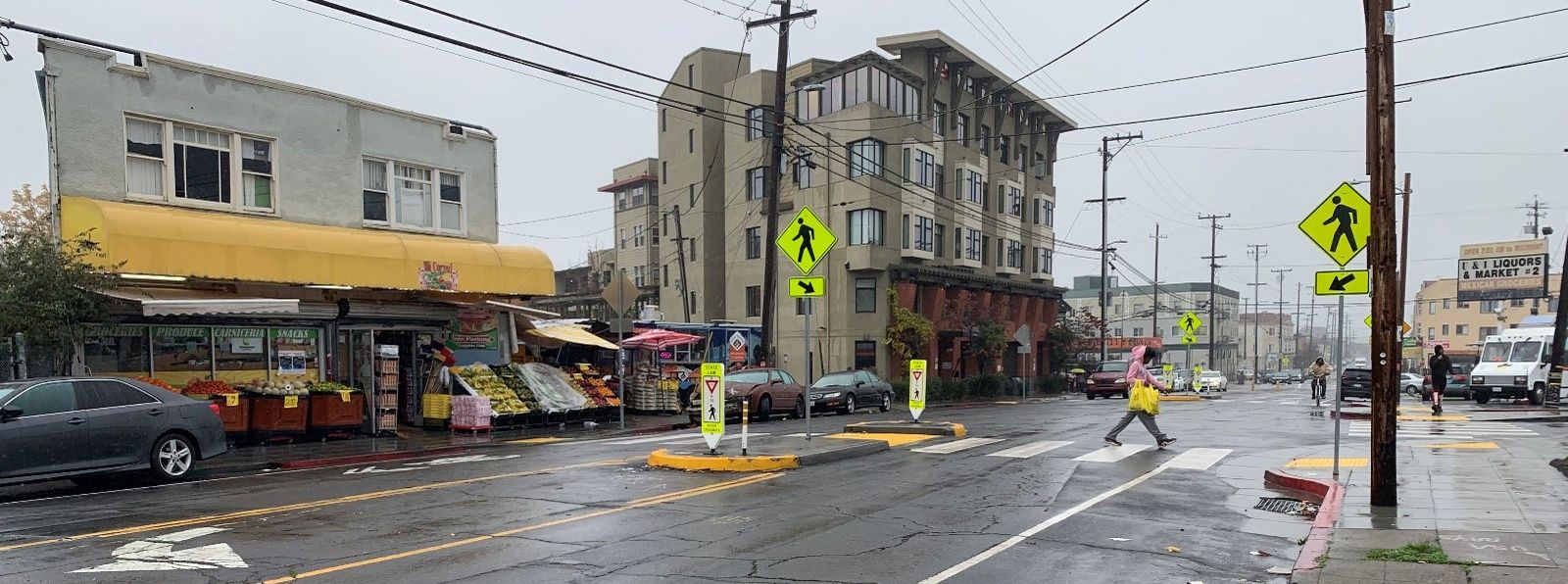
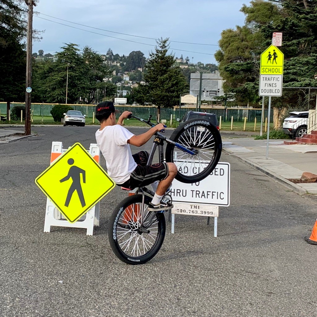
As soon as the health crisis hit the US, the City of Oakland, California quickly announced its Slow Streets emergency programme to adapt the city’s public space. Using mobile barricades and signs at intersections, some streets got closed for vehicles in order to make it safer for pedestrians and cyclists to move in residential neighbourhoods. Soon, other uses emerged, transforming these streets into playgrounds, places for cultural expression and for events of all kinds. But while some have been fully appropriated, others remained little used by residents. During the summer of 2020, surveys were conducted on the Slow Streets. The following Interim Findings Report2 revealed that the programme has mostly been a success in neighbourhoods inhabited by the white and wealthier community and has often not been well understood and received by other communities. It was in this context that the programme was extended by Essential Places: securing dangerous intersections and shopping areas through tactical interventions using light materials. This new scheme has responded more specifically to the needs identified by communities.  
With 74 miles (about 120 km) announced in April 2020, Oakland's Slow Streets quickly became a model for other American cities such as San Francisco, Seattle, Baltimore, and Washington D.C. However, only about 21 miles (about 34 km) have finally been implemented and their future remains uncertain. Making this design permanent would require the developing of a new and post-pandemic model of streets, that could be used for active modes, play and strolling while remaining accessible to local residents in vehicles, deliveries and city management services (waste collection, and so on). At the same time, this new type of street would have to meet all streets and safety regulations. Another uncertainty today is the financing of the permanent designs for a city that has limited resources. 

Oakland’s Slow Street and Essential Places programmes have nevertheless made it possible to open a dialogue with the communities, and especially with those who were often forgotten by public services. With Essential Places, the city was able to quickly solve road safety problems. These sites also seem easier to manage and finance. Several Essential Places have already been transformed into permanent designs. However, given the problems of financing, comprehension and management, community involvement remains an element that needs to be improved in order to ensure the sustainability of temporary Slow Streets, which seem to be gradually disappearing from Oaklands streetscape.
In January 2022, the Oakland Department of Transportation (OakDOT) has finally announced the end of the existing temporary designs, proposing a new phase of the program relying on three strategies3:

  • Essential Places expansion. To increase the safety of active modes, especially near essential services, OakDOT  proposed to use temporary designs briefly, but systematically transform them into permanent designs.
  • Implementing a network of permanent Slow Streets. 
  • Developing new Pop-up Slow Streets. OakDOT imagined this new tool for temporary street closures, as a way for supporting neighbours’ use of streets as community space, especially for the organisation of events. 

Open Streets: a difficult appropriation of New York’s streets by its residents

With its Open Streets (OS), New York City also launched a programme in March 2020 to respond to the challenges of physical distancing and to avoid the overcrowding in parks and gardens. Taking the form of temporary street closures to traffic or transit (except for residents, deliveries, and services), the aim was to encourage New Yorkers to walk or cycle and engage in outdoor activities. Unfortunately, the first edition of the programme was a failure and after only 10 days, the city decided to withdraw the pilot projects. The facilities were not understood and little use by residents was observed. Local associations (pro-pedestrian and pro-bike) then mobilised to demand the return of the programme with an adapted procedure: The Open StreetCoalition4 was created, enabling to bring the voices of the project's defenders before the city council. For example, it was pointed out that the first series of OS were too short and located in neighbourhoods where the needs had not been well identified. The massive presence of the municipal police and the devices (barricades) put in place to secure the streets represented an obstacle for the local population. Thus, the Coalition called for a less heavy and more local management. 

This mobilisation therefore helped the launch of a second edition of Open Streets, located on longer stretches and in residential neighbourhoods lacking parks and green spaces. This time, the sites were identified by local associations in conjunction with local residents. In the summer of 2020, the communities even took over the management of some of these streets. Since then, the OS have quickly become the site of various outdoor activities, also in popular neighbourhoods. In others, Business Improvement Districts5 have taken over the management of the streets. However, the gaps have once again become more pronounced between the poorer districts and the better-off ones. In richer neighbourhoods, access to resources was better and they more easily applied for funds from NGOs to finance management, maintenance, and programming. The poorest neighbourhoods had to rely on the work of volunteers, quickly exhausted by the many difficulties that ensure OS management. With limited opening hours, the deployment of furniture, barricades and games, the daily management of the Open Streets represents a major task. The volunteers sometimes also received complaints and threats directly from opponents of the project. As a result of this feedback, partnerships between the Open Streets in poor and in wealthy neighbourhoods were created in order to better redistribute the funds obtained. In the future, long-term financial support is needed to ensure the sustainability of the programme and its management. However, a permanent closure of a large part of these streets would considerably reduce these costs. In early 2022, some Open Streets still rely on volunteers for management and support. The city has provided assistance through the City Cleanup Corps6, who help keep the streets clean. In some cases, they have taken over management of Open Streets. 
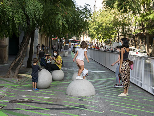
Meshed throughout the city, as linear parks or calmed corridors, Open Streets could transform the quality of life in neighbourhoods and improve the daily commuting for New Yorkers. But this long-term vision on Open Streets and their opportunities to transform public space is missing at this stage. Since 2020, 274 Open Streets have been created, but only 126 remain active in October 2021. With a total of about 24 miles (39 kilometres)7, the goal of 100 miles (160 kilometres) announced at the beginning of the programme by then-Mayor Bill de Blasio seems far away. The application for new Open Streets is open, but before committing to new projects, the Coalition is calling for all Open Streets to be made permanent and open 24/7. The first Open Street transformed into a permanent design was Dyckman Plaza, in Washington Heights (Manhattan)8. The permanent design for this former Open Street, which had been maintained by local restaurants that used the space to provide outdoor dining and events, was inaugurated in December 2021. None of the volunteer-led Open Streets have been announced to be made permanent yet, but community stakeholder meetings were held in 2021.
The examples of Oakland and New York, both of which have developed specific tactical approaches in response to the health crisis, show the importance of involving local communities, associations, and organisations in projects. To make programmes work and/or validate their value and adapt them, dialogues are needed between public actors and citizens. Management and financing must also be considered in order to develop hybrid operations between all parties. The flexibility of the tactical approach allows time to adapt both the temporary designs and the administrative procedures behind and to define the skills and investments of each party in the long run. It is at this price that a rich programming of projects could emerge, more in line with the cultural and social diversity of the inhabitants of the neighbourhoods and around a common objective: their well-being. 

Lisa Gaucher

Lisa is an architect who graduated from the École d'Architecture de la Ville & des Territoires Paris-Est. She has been project leader in the Planning, Development and Regions department at the Institut Paris Region since February 2020, and explores the benefits provided and issues raised by the tactical approach in the context of public space. She is also interested in energy-related issues in the Paris Region; infrastructure that will eventually become brownfield; the conversion of buildings; and the use of bio-and geo-sourced materials in the construction industry.

Maximilian Gawlik

Maximilian is a landscape architect and urban planner who graduated from Dresden Technical University and Sciences Po (Paris). After working in architecture, urban design and landscape architecture firms in Paris and Zurich, Maximilian joined the Institut Paris Region in 2019. His role is to support regional and metropolitan bike use policy and to study the energy-related, digital and spatial impacts of data centres. Since 2020 he has been working on the subject of temporary installations in public space.  

1. Referred to as the programme announced during the health crisis by the City of New York. Like Play Streets, Open Streets is a well-known concept in the United States, especially used for events.
2. https://cao-94612.s3.amazonaws.com/documents/Oakland-Slow-Streets-Interim-Findings-Report.pdf
3. https://www.oaklandca.gov/projects/oakland-slow-streets
4. Led by Transportation Alternatives, Bike New York, Tri-State Transportation, the Regional Plan Association, and many others. The Coalition is still active. In 2021 it organised data collection on Open Streets with the help of volunteers.
5. Born in North America and particularly widespread in Anglo-Saxon cities, Business Improvement Districts (BIDs) are shopping districts that function thanks to an agreement between the municipality and the private sector on the management of streets and streetscape. Businesses and shop owners pay an additional tax (levy) in order to fund projects and improve the environment within the district’s boundaries.
6. https://www1.nyc.gov/site/safestbigcity/keep-nyc-safe/city-cleanup-corps.page 
7. https://www.transalt.org/open-streets-forever-nyc 
8. https://www1.nyc.gov/html/dot/html/pr2021/dyckman-plaza-transforms-inwood-open-street.shtml 

See also

This page is linked to the following category :
Urban planning