From the mid-twentieth century onwards, the “car-oriented city” model was superimposed onto the nineteenth-century railway city and the pedestrian city of previous centuries, prompting urban sprawl and making cities dependent on fossil fuels. Today, are we trying to develop compact cities, car-lite cities and even car-free living. But what about suburban areas? And what about the expected arrival of robots in our streets? Will the future of our cities be human?
Although the model of the city organised around its roads retains its allure in emerging megacities, it has been challenged since the late twentieth century in developed cities. Many cities are seeking to end their dependence on cars via planning and mobility policies that are more or less integrated on different scales. Thus we find:
- National legislations banning the construction of suburban shopping centres (UK, Netherlands, German Länder);
- Long-term planning that seeks to protect natural areas to encourage compact urban development (Amsterdam, Copenhagen, Portland, Hong Kong, Seoul, Singapore);
- Massive investment in transport infrastructure, coupled with the urban development of new metro corridors (Madrid, Copenhagen, Vancouver), tramway lines (Stockholm, Los Angeles, Sydney) or express bus lanes (Bogotá, Rio, Istanbul, Seoul) ;
- Policies fostering density and mixed use i post-industrial cities (Paris, Milan, Hamburg, Stockholm), sometimes with tall building development (London, Vancouver, São Paulo, Shanghai);
- Overall walkability strategies1 (Madrid, Munich, Copenhagen), initiatives stimulated by temporary experimentation (Bogotá, San Francisco, New York) or highly symbolic transformations (Paris, Seoul, Buenos Aires).
These policies have met with some success in city centres, but they have rarely affected suburban areas, increasing the risk of two-speed cities. In the last decade, the idea of the street as a medium for urban wellbeing has emerged (e.g. Healthy Streets in London). The Global Street Design Guide2, signed by city mayors from all continents, suggests giving priority to social needs rather than traffic when streets are designed. In North America (San Francisco, New York, Portland, Montreal, Vancouver), in Europe (Birmingham, Lyon, Liège, Utrecht, Helsinki) and in Asia (Seoul), cities are converting urban freeways into more peaceful boulevards and park corridors, with positive effects in terms of traffic, urban regeneration and the environment. Some twenty metropolitan regions worldwide, including Paris, are considering transforming highways into urban boulevards3.
Regional cycling initiatives
Over the past ten years, biking has emerged as a major transport mode. In the early 2010s, 23 towns in the capital region of Copenhagen began to create an express cycle network as an alternative to cars (and trains) on sections 5 to 30km long4. Some of the 170 km of express bike lanes have been built, and some stretches are used by up to 40,000 people a day (more than many roads)! By 2045, 746km should be completed, at a cost of 295 million euros, bringing a profit of 765 million to local authorities (including public health benefits). This strategy has been copied in London (Transport for London has an annual bike budget of 190 million euros), elsewhere in Europe, in the Americas, in Australia, and in China. The new bike culture produces some spectacular architecture (Snake Bridge in Copenhagen, Skyway in Xiamen, Tilikum Bridge in Portland), but the challenge is above all to create a comfortable, safe and continuous network across all areas. This is the Achilles heel in the Paris Region. The Region has just adopted a new Bike Plan that aims to treble bike journeys by 2021, with funding of 100 million euros. Bike parking is starting to be taken seriously: in the Tokyo region, automatic silos for 10,000 bikes are not uncommon; Utrecht station has a bike park that will eventually accommodate 22,000 bikes—a reference for the future stations of the Grand Paris Express metro. These facilities are combined with “bike-centred planning” integrated into the development of urban districts (Sluisburg in Amsterdam). Bikes call for modest investment and boost the perceived value of areas that are hard to get to by car and, when combined with trains, of suburban and rural areas. One study5 shows that in Europe, every kilometre covered by car costs local authorities 0.11 €/km, while cycling and walking generate profits of 0.18 €/km and 0,37 €/km respectively.
Car-free cities?
More and more cities are preparing for a future less dominated by cars, encouraging car-sharing and reducing the number of available parking spaces. London is planning a massive transition to alternative means of transport to lighten the load on its roads: each urban development will have to contribute to the objective of the new London Plan to increase the proportion of journeys on foot, by bike and by public transport to 80% by 2041 (compared to 63% in 2017). In Inner London, which is 3 times larger than Paris City, all new property developments should be car-free (without parking). In New York, the Regional Plan states that, by 2040, only 20% of streets should be used by cars (compared to 57% today) and 10% for parking (25% today). Singapore aims to ensure that 75% of rush-hour journeys will be made by public transport by 2030 (66 % in 2014), and that 80% of homes will be less than 10 minutes from a station.
Singapore was the first city to install an urban toll system to halt the growth of car traffic in the centre and on certain major roads. It will soon be replacing the toll barriers by a fairer GPS system based on distance travelled. Other cities have adopted tolls for access to the city centre, combined with extensive low-emission zones, such as London (since 2003), Stockholm (since 2006) and Milan (since 2011). In Oslo, Bergen and Trondheim, these tolls form part of a “mobility package” that funds roads, public transport, cycle lanes and pedestrian improvements. New York is following suit after 20 years of debate: the state will set up a toll for vehicles entering the south of Manhattan to reduce congestion and generate a billion dollars annually, which will be invested in public transport. The congestion charge is very useful for reducing traffic (by 10 to 30%) and pollution, and is popular wherever it has been set up. In France tolls are seen as unfair from a social and regional standpoint, but while traffic jams penalise users and society at large indiscriminately, congestion charges can foster modes of use that are more socially useful to the community and prioritise trips without attractive alternatives (while raising funds for public transport). In response to urbanites’ aspirations towards a “liveable” city, an increasing number of experiments are being carried out with the car-free city in mind: in many neighbourhoods in Stockholm, Malmö and Copenhagen, parking is no longer allowed on the street: instead there are multi-storey mobility centres whose roofs serve as public squares or school playgrounds. With its Car-Free Livability programme, Oslo intends to free the city centre of cars, as in some Italian cities. In Bremen and Hamburg, residents subscribe to car-sharing programmes, which frees up courtyards to be used as gardens. Helsinki plans to make private car ownership obsolete by 2025 by providing generalised access to an on-demand multi-modal mobility service.
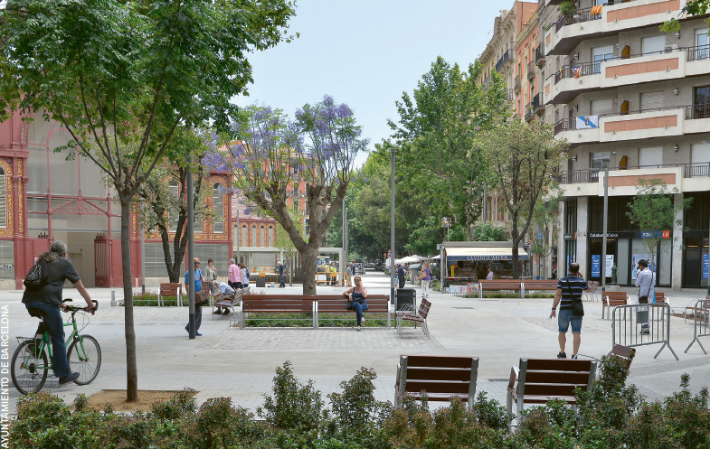
Walkable suburban areas
Since the early 2000s, these strategies, combined with societal and technological changes, have helped to restrict the presence, use and ownership of cars in the central areas of developed cities. They have made them more lively, often more liveable…and less affordable. But these methods have turned out to be powerless to change the lives of suburbanites who still have to use cars and whose lifestyle is financially and ecologically unsustainable. One of the major challenges, especially in the Paris Region, is to make suburban areas walkable, cyclable, dense and lively, and to invent a form of local planning centred around hubs offering rapid access to metropolitan jobs and services by train, express bus services, car-sharing programmes, or on-demand public transport6.
Robots in our streets
With air pollution, congested road networks are a typical problem in attractive and poorly regulated metropolitan areas. For the moment the explosion of digital use (with Uber, Amazon, AirBnB, etc.) has worsened congestion, while contributing to the artificialisation of farmland with warehouses and global warming with data centres. What does the future hold? What will the impacts of the digital revolution on our cities be? One disruptive factor will be the driverless car. Digital majors and car manufacturers highlight the potential of its use in cities: less traffic, less congestion, less pollution and accidents, conversion of car parks, unsealing roads to cool down the city, easier access to healthcare, etc. While the legal, safety-related and ethical aspects are under debate, the risks for urban living remain relatively unexplored: who will decide on the algorithms that will regulate the cohabitation between robot vehicles, non-driverless cars and humans? Will councils and citizens have any sway over giant multinationals? Will urban space be subject to the “requirements” of machines? Will cities be dehumanised, and will humans lose control of their environment? In the past, promises based on technological visions have not been kept. Channelling rivers and burying polluted watercourses have reduced neither flooding nor water pollution. Cars didn’t save cities by allowing city-dwellers to live in the countryside, as many experts in the twentieth century in the United States believed they would: in fact, cars almost killed cities! And building more roads and motorways has not solved congestion: quite the contrary, in fact. These subjects merit careful thought and debate if we want to invent a human-centered urban future.
Paul Lecroart, Senior Urbanist, L’Institut Paris Region
1. See Walk21, www.walk21.com
2. Global Street Design Guide, Global Designing Cities Initiative, NACTO, Island Press, 2016.
3. LECROART Paul, “Reinventing Cities: From Urban Highway to living Space”, Urban Design #147, Summer 2018. Also: La ville après l’autoroute. Études de cas (New York, Séoul, San Francisco, etc.), IAU îdF, 2013-16.
4. Capital Region of Denmark: Cycle Superhighways, Office for Cycle Superhighways, 2019.
5. GÖSSLING, Stefan et al. The Social Cost of Automobility, Cycling and Walking in the European Union, Ecological Economics, Vol. 158, April 2019, p. 65-74.
6. Les Cahiers n° 175, La vie mobile. Se déplacer demain en Île-de-France, September 2018.
