
 classification in Urban Morphological Blocks (IMU) in the Île-de-France region")
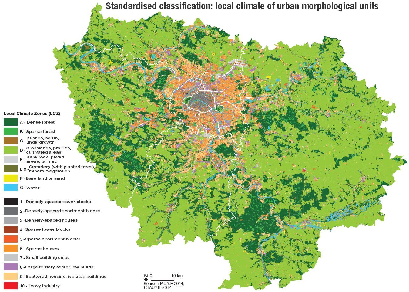

 Source: IAU îdF © IAU îdF")
Classification of Local Climate Zones by Iain D. Stewart and Timothy R. Oke according to age
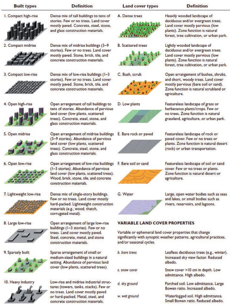
The system of LCZ classification for rural and urban areas according to their thermal differentiation was established by Iain D. Stewart and Timothy R. Oke (Department of Geography, University of British Columbia, Vancouver, Canada).
LCZs are defined as uniform spatial entities by distribution of combined air and surface temperatures between 100 and 1000m on a horizontal plane.
Each LCZ expresses a characteristic geometry and type of land use that generates a specific climate - a unique surface temperature - during times of calm weather and clear skies.
Zones are differentiated according to surface properties, which have a direct influence on references temperatures (1.5 - 2 m above ground level), such as the proportion of vegetation, height and distribution of buildings and trees (roughness length/compactness), ground humidity and anthropogenic heat fluctuations. According to these differentiations, the urban-rural continuum gives a hierarchy of 17 climate zones: 10 "Building" LCZs; 7 "Land cover" LCZs.

Causes of the UHI effect by Timothy R. Oke (1982)
• Greater absorption of solar rays due to multiple reflections as well as trapping in vertical building surfaces and walls of apartment blocks in cities (multiplication of surfaces, lower albedo of urban materials (cf. "Glossary").
• Greater retention of infrared rays in "canyon" roads (due to high, compact surrounding buildings) at night, because of reduced albedo "sky view factor" (cf. "Glossary", ).
• Increased trapping and slower release of heat by buildings and artificially covered surfaces in cities (thermal properties of various materials, trapping of solar and infrared rays, reduced loss of heat by convection at canopy level where air flow is slowed).
• Greater proportion of solar rays absorbed by surfaces are converted into sensible heat (changing the temperature of a surface) rather than latent heat (where a material's physical state changes rather than its temperature). This effect is due to the replacement of humid ground surfaces and vegetation with artificially-covered, impermeable surfaces leading to lower levels of surface evaporation.
• Greater emission of sensible and latent heat due to the combustion of petrol by urban transport systems, industrial procedures and the heating/cooling of dwellings and residences.


