Rethinking post-carbon cities
From expressways to boulevards
In the post-carbon city, what should we do with urban expressways inherited from post-war automobile-oriented thinking? This is a subject of hot debate and exciting projects. Converting these arteries into boulevards opens up prospects for re-thinking city planning, public space, mobility and sustainability.
In developed countries, transforming urban expressways carved through cities during the post-war boom years without any consideration for the environment is a major issue for contemporary urban planning and management. Expressways still play an important part in moving people and goods in metropolitan areas, but they create barriers which devitalize city centres, neighbourhoods and waterfronts. They generate harmful effects on communities living in their environment, including noise, air pollution, health problems and social injustice. By providing easy facilities to reach city-centres for car-owners, extensive urban highways networks tend to encourage car-centric lifestyles which, in turn, lead to urban sprawl, and to more traffic congestion.
Paris metropolitan region has a dense interconnected mesh of over 500 km of expressway extending from within the Périphérique ring at the heart of the metropolis to the A104 ring highway on the urban fringe. Until recently, decking over or tunnelling parts of these highways was seen as a solution to sew neighbourhoods together and unlock redevelopment potential; but this type of solution is not imaginable on a large scale and does not address the environmental and the mobility issues.
Would removing urban highways or converting them into multimodal boulevards be a smarter scenario for Paris and other cities? This is a hot debate in the Paris region where half a dozen projects of expressway transformation are currently being studied, planned or have been recently implemented such as the Seine riverbanks expressways.
Learning from other international experience
Worldwide, many cities have successfully started tearing out obsolete expressways. How did they make this possible? What happened with the Traffic? What were the effects on city development, on the environment, on public health? What can we learn from those experiences?
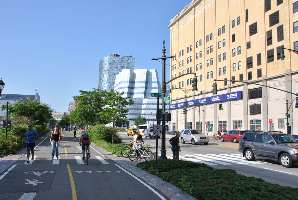
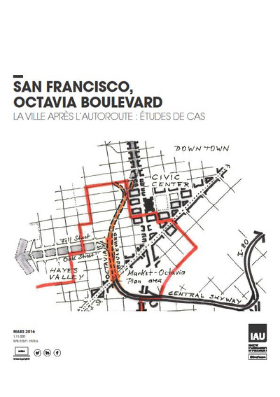
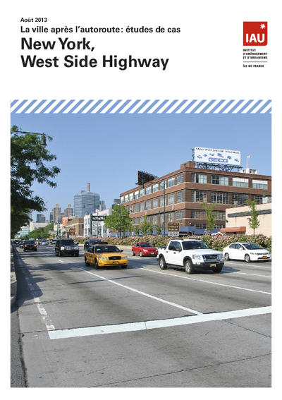
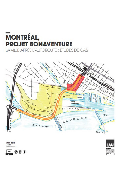
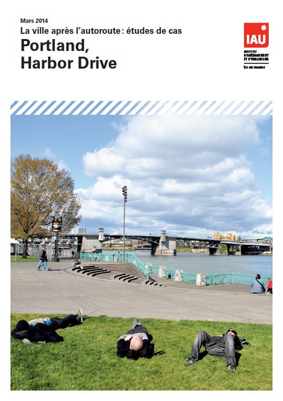
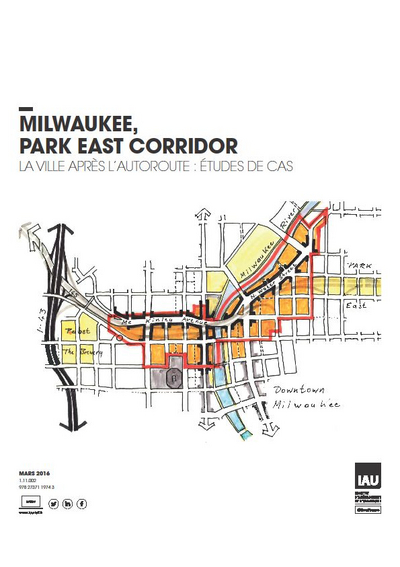
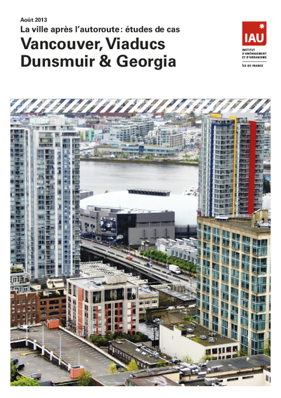
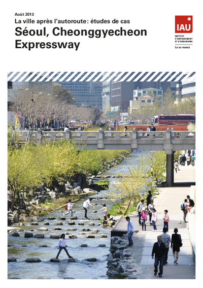
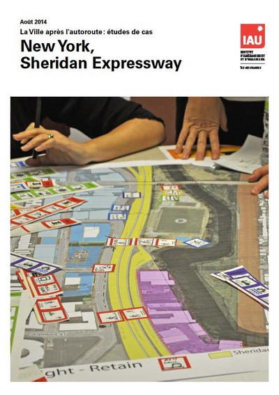
To find answers to those questions and others, L'Institut Paris Region studied nine experiences of expressways transformation(1): Portland (Harbor Drive), New York (West Side Highway), San Francisco (Embarcadero Freeway, Central Freeway), Milwaukee (Park East Freeway), Seoul (Cheonggyecheon Expressway), New York (Sheridan Expressway), Montreal (Bonaventure Expressway), Vancouver (Dunsmuir & Georgia Viaducts), and Toronto (Gardiner Expressway).
Most of cases studied are located fairly close to the city centre, with one on the outskirts of the city (Sheridan Expressway). About half of the former expressways were part of cross-city links, the other half ending in the city centre. Many of these arteries were supporting heavy traffic volumes before being removed, in some instances well over 100,000 vehicles per day.
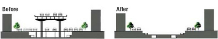
The reasons for removing a highway can be diverse. In six cases, the expressway transformation is related to carry out an urban renewal project. In four other cases, the project was caused by an event (earthquake or accident) that weakened the elevated infrastructures. Everywhere these projects aroused fierce debate city-wide: should the lifespan of the expressway be extended? Should it be rebuilt on site? Should it be decked over or replaced by a tunnel? Or should it be transformed into a boulevard? This latter option was ultimately chosen in most cases, with two exceptions: Boston and Seattle where it was decided to double the surface boulevard with a tunnelled expressway.
Case studies available in French only
Urban and economic renewal of cities
In all of the case studies, the transformation of expressways into boulevards has had very positive urban, landscape, and economic impacts: in Portland, San Francisco, New York, Seoul, Milwaukee, and Boston, the projects facilitated the renewal of the city centres and of the neighbourhoods blighted by the infrastructure. The disappearance of the physical and visual barrier, the reduction in the pollution and inconvenience, the reconnections between neighbourhoods and the quality of the new urban spaces, have all contributed regenerate whole city districts. In all of the cases studied, the boulevards that have replaced the expressways have become genuine multi-use public spaces.
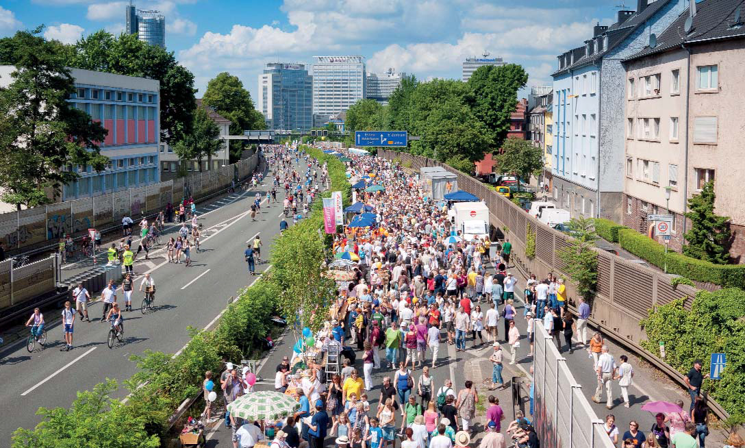
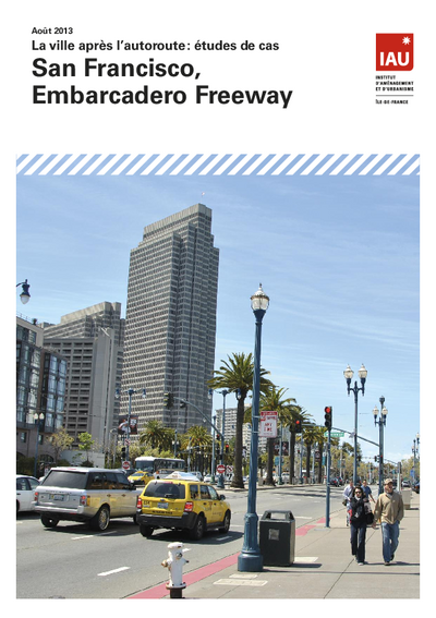
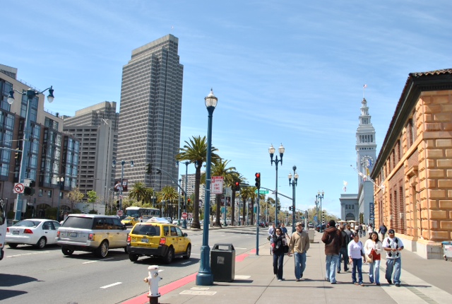
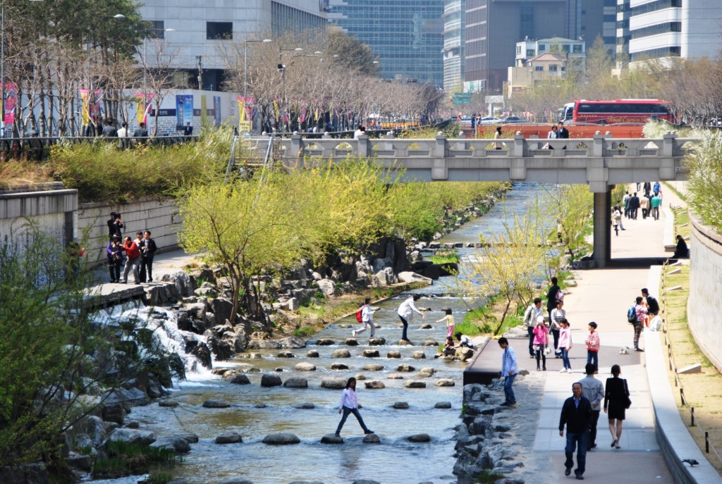
For example, in San Francisco, removing the Embarcadero Freeway has o the waterfront back to the city. It has enabled retail outlets, leisure facilities, and housing to be created, and has developed tourism. In Seoul, since the demolition of the expressway, the banks of the Cheonggye stream have become the “Champs-Elysées” of the city (with over 100,000 visitors on peak days!). Deconstructing highways and their flyovers frees up tens of hectares of land that can be reclaimed for dense and mixed-use neighbourhoods (Milwaukee, Toronto, Montréal, Vancouver), for housing (San Francisco/Central, New York/Sheridan), or for linear parks (Portland, Boston, Seoul). In the medium term, the economic and urban transformation makes itself felt beyond the artery itself (New York, Seoul).
Traffic evaporation
In spite of initial fears, removing the expressways did not make traffic conditions worse, beyond initial adjustments. It was observed that traffic switched to the local network where spare capacity existed (Seoul, San Francisco, New York), but the amounts that switched remain limited and smaller than forecast.
Mean daily traffic on the corridors in question decreased, even including the traffic that switched:
-10% in Portland, -20% in New York (West Side)(2), -22% in San Francisco (Central), -35% in Milwaukee, -70% in Seoul. In Seoul, the project and related transport policy led to a 9% reduction in the traffic passing through the city centre, and to a 2.3% reduction in the traffic going towards the centre, resulting in a reduction in the car journey times across the city(3).
In all cases, the private motor vehicle trips which were lost do not transfer in full to public transport: there is what transport experts call “traffic-evaporation”. This can be explained if we take into account the “induced demand”: by building new expressway capacity or “supply”, one generates new traffic that grows over time(4). Conversely, when one reduces the supply then traffic decreases.
Behavioural changes unpredicted by the models
The removal of the godsend effect of the expressway changes the way motorists behave: they change their routes or the times at which they travel, they switch to public transport or to car-sharing, walking or cycling. Some reduce the frequency and/or range of their travel: in San Francisco, 20% of users declared they travelled less after the Central Freeway was closed.
The reduction in road capacity makes car users think twice about their travel patterns which may lead to giving up altogether less useful trips. This result confirms empirical observations (Jacobs 1961) and research findings: an analysis of 60 cases of road capacity reduction in 15 countries (Cairns et al, 1998) showed an average reduction of 25% in the traffic in the areas or corridors affected. Individuals, households, and businesses have quite considerable capacities to adapt in the short and longer terms. This elasticity in behaviour is not integrated into traffic simulations that tend to overestimate the road capacity needs.
This is illustrated the other way round by the case of the Big Dig in Boston: the induced demand created by the new capacity across the city centre has generated unforeseen growth in traffic on outlying sections, leading to an increase in journey times in the conurbation.
More accessibility for everyone
Some cities are backing up removal projects with purpose-built transport policies. For example, in Seoul, the actions have concerned the transport supply (in particular a high-quality bus service) and management of demand (tolls encouraging car-sharing; increased parking fees, limited supply and better enforced car parking, etc.) with this policy being strongly relayed by the media.
In any event, local accessibility is eased by removing unnecessary detours not only for pedestrians, cyclists, and people with reduced mobility, but also for motorists, taxi drivers, and goods delivery. Reduction in mobility expressed in terms of vehicles often means increased accessibility for people.
In San Francisco, the streetcar system built on the former Embarcadero expressway corridor absorbs over 25,000 passengers per day. Pedestrian and cyclist mobility has increased tenfold with the new boulevard. Similar effects have been observed in New York and in Seoul, also with considerable increases in the static uses of the public space for leisure and pleasure.
More public usage can initially imply an increase in the number of accidents involving pedestrians or cyclists, sometimes related to design faults. The careful design of these boulevards with four, six, or even eight lanes of busy traffic is the key to successful sharing between the various uses. With calmer traffic and better distribution of traffic, the neighbourhoods and the cities run better.
Ultimately, what we see is the shift form a system providing fast mobility for “some” (the motorists) to a system of slow accessibility for all.
Environment and climate: positive impacts
The simultaneous reduction in the speed and volume of motorised traffic and in the miles travelled reduces fossil fuel consumption, and CO2 and fine particle emissions. It (slightly) reduces noise pollution and perception of such pollution. The effects of these projects on public health(5) show potential significant improvements where assessed (Montréal) due to the combination of a reduction in exposure to factors responsible for respiratory and cardiovascular diseases and the encouraging physical exercise (walking, jogging, cycling)(6).
These projects can have a significant impact on local climate: in Seoul, the summer air temperature on the site of the former expressway is 5°C lower than on the arteries running parallel to it; the biodiversity of the corridor has apparently also increased strongly over the period from 2003 to 2008.
A favourable cost-benefit ratio?
Transforming an expressway has a cost: the amounts invested are, on average, about 35 million to 70 million euros per kilometre. In view of the costs of maintaining or of rebuilding infrastructures that are nearing the ends of their life cycles, transformation however often proves to be the cheapest and the one that benefits the largest number of people. The amounts involved are very much higher when elevated or at-grade highways are replaced by tunnels: the Big Dig in Boston cost over 2 billion euros per kilometre, while it has been estimated that the Seattle project will cost over 700 million euros per kilometre.
In the United States, the projects are funded by a combination of federal, state, and local funds. In Canada, funding may rely on the prospects for redevelopment of publicly-owned land by local governments.
Complex processes; public support?
In all cases, transforming expressways into boulevards results from long, complex, and uncertain processes, in which citizen participation, hearing opposing technical expertise, and political leadership play key parts. These projects require determined mayors or governors, smart research and steering, and negotiation skills in order to make divergent visions to converge; they involve a good deal of risk-taking.
Controversial to begin with, these projects generally win over the populations afterwards: for example, the Cheonggyecheon restoration aroused such enthusiasm in Korea that it served as an electoral springboard helping Lee Muyng Bak to become Mayor of Seoul in 2002, before he became President of the Republic of Korea in 2006.
Symbolic actions or paradigm shifts?
The expressway transformation projects have had strong symbolic impacts because they affect objects that were long seen as being synonymous with modernity (living fast) and with freedom (the motor car). These projects turn their backs on the functionalism that marked the latter half of the 20th century to go back to the fundamentals of the city, its geography, its history, and it public space: hence the success of removing expressways from seafronts or riverbanks.
Cities like New York, San Francisco, Seoul, or Vancouver have written their projects into sustainable development visions and compact, low-energy citywide strategies that translate into urban planning, mobility plans, cycle plans, climate plans, etc. In the United States, the country of the automobile par excellence, the success of the first projects encourages other cities(7) to look at removing obsolete expressways.
Learning from international experience
In view of these analyses, we propose a few ideas for the debate:
- Transforming city-centre expressways into boulevards encourages people to change their travel patterns: less useful car-trips tend to disappear, eco-friendly transport modes (including car-sharing) tend to increase. This can free up road capacity for economic needs such as higher added value car-journeys or goods distribution.
- These projects lead to interesting compromises between urban life and metropolitan mobility: the improvement of local accessibility is not detrimental to longer-distance metropolitan or regional trips;
- Replacing an expressway with a well-connected, good-quality public street network creates added value. This opens up the possibility of regenerating and of intensifying neglected urban spaces;
- A well-integrated urban boulevard offers a comprehensive metropolitan level of service connecting people and activities, while transporting as many people as a highway but at a slower speed(8). A boulevard tends to connect more than to separate; it can also accommodate housing, commercial and industrial premises, service facilities, etc. A boulevard enables social interactions to take place which is ultimately the raison d'être of cities and a key to their economic performance.
Prospects for the Paris Île-de-France metropolitan region

To conclude, these international case studies are interesting references for highway and city transformation worldwide. These results are in line with what we have learnt from our own experience of the kind in the Paris region, namely the redevelopment of the Paris-La Défense Express Ring, the Paris Right Bank Expressway transformation, and the Left Bank Expressway removal. Paris region has also a successful experience in transforming six major roads corridors into “tramway boulevards” giving the opportunity to redesign public space and redevelop the edges.
Many more projects are in the pipeline, including the pedestrianization of a 3 km section of the Right Bank Expressway, the removal of the A186 highway in Montreuil (East of Paris) and the first reserved bus, taxis and car-sharing corridors on A6 and A1 highways within the framework of the Multimodal Regional Highway Plan (2014). Following the approval of the Regional Master Plan Île-de-France 2030 and Regional Mobility Plan (2020), arrangements have been made for reclaiming more quasi-expressway roads into tram- or bus-rapid transit-boulevards, with redesigned public space for cycling and walking, and urban intensification. A reflexion may start soon on the future of the Paris Périphérique which is currently a physical barrier between the city and its inner-suburbs and hinders development of the Grand Paris as a whole.
International experiences offer food for wider rethinking the functions, uses and status of urban expressways in smart and sustainable cities-regions. This kind of specialized automobile-oriented infrastructure may well be a costly heritage from obsolete planning concepts. Profound changes are affecting the behaviour patterns of people and businesses, and the way cities and city-regions are organised. Many developed cities in the world, including Paris, New York, Los Angeles, Tokyo, London, Stockholm, have been experiencing an overall reduction in car use, car traffic levels, and car ownership in the last decade.
Rethinking the existing urban expressways network of large cities may well be a smart way to address together local aspirations and metropolitan development challenges, and global climate-related issues. But it not just about highway design: it is about rethinking the planning, mobility, lifestyles, and wealth production of our city-regions. A major transdisciplinary task.
1. LECROART Paul, Fins d’autoroutes, renaissances urbaines : la transformation de voies rapides en avenues, L'Institut Paris Region (forthcoming). Case studies can be downloaded on www.institutparisregion.fr (in French).
2. SCHWARTZ Sam, interview 31 May 2011.
3. HWANG Kee Yeong, interview 14 April 2011.
4. In France, studies have estimated the average level of induced traffic to about +40% after ten years; cf. Cete Sud-Ouest, Estimation du trafic induit par un aménagement lourd, Setra, Ministère de l’Équipement et des Transports, August 1992.
5. In the Paris conurbation, 3 million residents are potentially exposed to pollution levels that exceed the levels stipulated in European regulations (Airparif 2012) and 2 million are exposed to façade noise levels that are excessive (Bruitparif 2010).
6. In the United States, excessive use of the motor car is a health risk with regard to obesity. For the Paris Region, cf. work done by the Observatoire régional de la santé (ORS, the Regional Health Observatory), and the debates at the Amif (Association of Île-de-France Mayors) Congress in 2012.
7. There are currently about fifteen projects or intentions to transform expressways in North America.
8. A 40 meter-wide boulevard carries as many people per hour than a 80 meter-wide highway.
This page is linked to the following category :
Urban planning